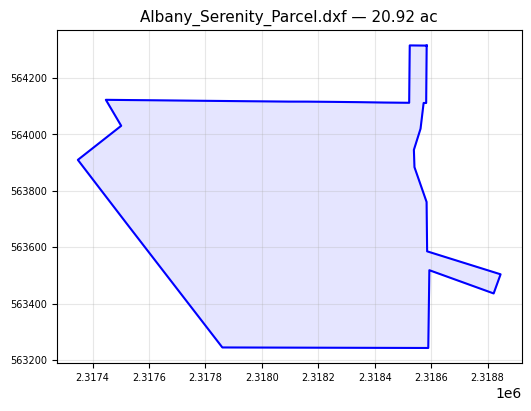
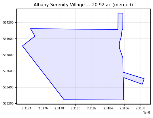
Albany Serenity Village
Location: Albany, GA
Parcels: 1
Site Area:
20.92 ac
20+ Acres Mock Rd
Parcels
| Name | PIN | Acres | File | |
|---|---|---|---|---|
| Albany_Serenity_Parcel.dxf | — | 20.92 | Albany_Serenity_Parcel.dxf |
Upload Parcel
Export Parcels
Download all parcels as a single file (includes lot boundaries and ROW).
State Plane = EPSG:2240 / NAD83 GA West (US Feet). Compatible with HEC-RAS.
Site Boundary (Merged)
Albany_Serenity_Parcel.dxf